
The earliest and most detailed mention of the Saraswati as an ancient Vedic river along with other Indian rivers is found in the Nadisukta hymn of Rig Veda (RV X:75.5). The Rig Veda describes it as the mother of all rivers, Sindhumata with copious milk and a strong flow in its purest form (RV VIII:36.6). It is the Naditama i.e. the foremost of all rivers (RV II:41.16). Irfan Habib (2001) however argues that Saraswati in the Rig Veda implies its appearance in four different forms. First as a goddess with the other two goddesses namely Ida and Bharati. Secondly, as a goddess of speech and ritual. In its third form, it appears as a river goddess and finally as a river. According to him, the latter interpretations of Saraswati have been superimposed on the first two.
The Puranas on the other hand, describe how the Saraswati river merged with the river Yamuna which then together joined The holy Ganges to form the Triveni Sangam at Prayagraj. It is believed that these three rivers represent heaven, earth, and the underworld, and the river Saraswati becomes visible only to the enlightened ones. While the literary description of this majestic and perennial river is fascinating, it is also equally important to understand why a river foregone long ago is being searched now. Why is determining the geographical position of Saraswati’s paleochannel so crucial? What significance does this lost Indian river hold?

(Source: Japji Travels; An aerial view of the Triveni Sangam at Prayagraj)
The search for Saraswati provides new insights into Indian history and would also be pivotal in understanding the origin of civilization in Ancient Indian History. It would make one aware of whether the presently known ‘Indus Valley Civilisation’ did survive on the river Indus or Sindhu as it was known or if was there a presence of another mighty hydrological feature as described in the Puranas and the Vedas. Numerous excavations led by archaeologists starting from Aurel Stein in 1941 to A. Ghosh and subsequently by M.R Mughal identified various sites beyond the Indus basin. Mughal identified the region between the Indus in the west and Yamuna in the east as consisting of sites identifying with a culture similar to the ‘Indus Valley’ or ‘Harappan’ Civilization and termed it the ‘Greater Indus Valey’. In 1974 there were about 363 new sites discovered which then sprang the debate over the nomenclature of the civilization. S.P Gupta in 1989 for the first time proposed a new terminology terming the civilization in India as the ‘Indus-Saraswati’ or ‘Sindhu-Saraswati’ Civilisation. While the term was not accepted widely in academic circles, it did spark a debate about whether the precise course of Saraswati’s Palaeochannels could be determined. Thus, understanding where this mighty Indian river originated, flowed, and perished is significant for understanding the beginning of Indian Civilisation and to what extent its existence affected life on the subcontinent.
TRACING SARASWATI: RIDDLES OF IDENTIFICATION AND DESICCATION.
The Rig Veda testimony exalts that the Saraswati flowed between the Yamuna and the Satluej and is a perennial river. However, it also acknowledges that later the mighty river was reduced into a stream which then flowed into an ocean. The most accepted dry valley course of the Saraswati River starts with its origin in the Siwalik Hills of the Himalayan mountains and flowed through Haryana, Southern Punjab, Northwest Rajasthan, eastern Sindh, and finally merged with the Arabian Sea through the Rann of Kacchh. The most popular and widely accepted identification of the Vedic Saraswati is being done with the Ghaggar-Hakra System, which is now a seasonal river. The first one to pin this identification was French geographer Louis Vivien de Saint-Martin in 1855. His assumption was based on the location of the Ghaggar between Yamuna and Satluej, as indicated in the Rig Veda in the case of Saraswati. This culmination of physical and literary evidence made him conclude that Ghaggar is the relic of the Saraswati system. Among those who accepted this theory were Max Muller, Aurel Stein, Monier Williams, and other Indologists.

(Source: Geographicus; An image of Louis Vivien de Saint-Martin)
V.N Mishra (2001) argues that the Ghaggar-Hakra system is the relic of the ancient Indian river Saraswati. According to him, the focus of the Harappan sites has been on the Ghaggar-Hakra and its tributaries. Marc-Aurel Stein, a British-Hungarian archaeologist discovered around fifty protohistoric and early historic sites along the banks of the Ghaggar-Hakra river, which now remains extinct for most of the year. Among all these sites was the famous site of Kalibangan. Mishra argues that the presence of settlements in this number alongside the basin signals the possibility that a perennial Indian river sustained them in the past. The river bed of the presently seasonal Ghaggar-Hakra measures between 3-10 kilometers throughout its course, for the greater part of its course, it runs parallel to and east of the river Indus. Ghaggar-Hakra system today is fed by seasonal streams which carry water provided by monsoon rains. For such a river, to be identified with the mighty and perennial Saraswati, Mishra argues that it would have received water from a perennial Himalayan river. This water according to him was provided to the Saraswati from the Satluej (identified as Shutudri in the Rig Veda) and Yamuna, both of which once would have merged with the Saraswati in the Ghaggar bed giving it a mighty stream. Prof.V.N Mishra goes on to argue that it is believed by the locals that the name of the town ‘Sirsa’ and fort ‘Sarsuti’ in Haryana might be the corrupted terminology of the ancient Saraswati river.

(Source: Michel Danino, The Riddles of Saraswati. A 1760 British Map showing Saraswati and Ghaggar by two different arrows)
The problem however arose later when scholars opposing the Ghaggar-Hakra identification theory, cross-examined the Indologist’s point of view. Archaeological data suggest that the center of the recognized region of ‘Lost’ Saraswati was abandoned around 1900 BCE. While this would have strengthened the Indologist’s position. Abandonment of the settlement meant that a civilization relied on an ancient river and the desiccation of the latter affected the settlement’s survival. The problem, however, arose over the issue of ‘Aryans’, who as argued by the mainstream Indologists composed the Rig Veda much later. If so, then how did they hail a shrinking river as a ‘mother of all rivers’? This underlines the problem of chronological inconsistency.
Over time, other explanations have come forward with different streams being identified with the Saraswati river mentioned in Ancient Indian history. These include Rajesh Kochhar’s (2000) identification of Saraswati with the Harahuvati or Haraxvaiti River (presently known as the Arghandab River) of Afghanistan. Irfan Habib goes on to argue that it might be possible that the myth of the Saraswati River is just a ‘castle in the air’ and that it denotes a term related to ‘River-Goddess’ rather than an actual river. However, such an explanation is contradictory to the literary pieces of evidence provided in various texts. These also include excerpts describing the disappearance of Saraswati.
The Mahabharata states that Saraswati disappeared at Binasana or Vinasana near Sirsa to avoid being looked at by the Nishadas. The Mahabharata also mentions that the Saraswati went underground but reappeared at three places which are namely Chamasodebheda, Sirodbheda, and Nagodbheda. However, the exact geographical positions of these places hitherto remain unestablished. But how did the Saraswati, a river so mighty as the mother of all rivers disappear? The Rig Veda mentions how the river later lost its force and turned into a stream which then meets an ocean. In 1971, Gurdip Singh conducted Palynological research that analyzed the pollen samples from the beds of four lakes in Rajasthan. The results published in 1990 described that the Holocene had three phases, in which the second phase was the wet phase with the heaviest rainfall around 5510-2230 BCE and since the Saraswati extracted a degree of flow from the rains, a shift to the Arid phase after an extremely wet phase, affected its flow.

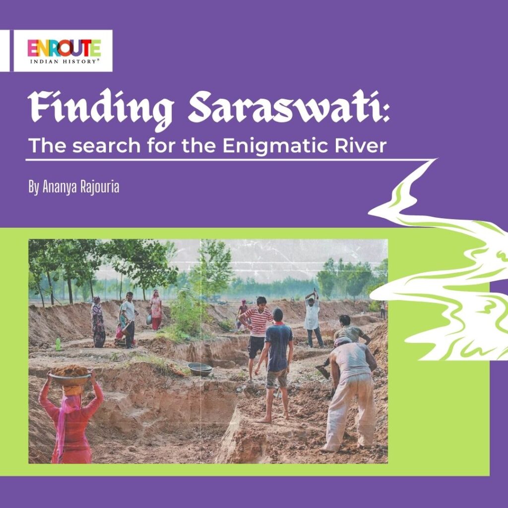
(Source: The Outlook; Excavations in the search of Saraswati)
However, the most prominent theory reasoning the disappearance of Saraswati is the breakaway of the Indian rivers Satluej and Yamuna streams from the Saraswati. Since The Saraswati is exalted in Rig Veda as flowing between Shutudri (Satluej) and Yamuna. A breakaway of these two perennial rivers would have significantly reduced the Saraswati’s flow. Such diversion of river course according to B.P Radhakrishna, occurred over different tectonic disturbances after 5000 BCE. Prof K.S Valdiya argues that the tectonic uplifts along the NE-SW trending fault led to the deflection of Shutudri and Yamuna. However, Zahoor Ali Khan argues that no geographical evidence of an earthquake or volcanic activity in the Himalayas during the Holocene has been unearthed that could lead two Himalayan rivers to divert courses dramatically. Peter Clift (2009) noted that around 2000-3000 BCE, flow in the Saraswati stopped due to the weakening of the monsoon and headwater capture into the adjacent Yamuna and Satluej.
While the search for the Saraswati that existed in Ancient Indian History continues to grapple with archeologists, geologists, and historians. Attempts have already been into motion by the government to rejuvenate the enigmatic river. The Saraswati Heritage Project started in 2003 by the NDA government was restarted in the year 2019. On 21st January 2022, the Government of Haryana and Himachal Pradesh signed a Memorandum of Understanding for the construction of the Adi Badri Dam on the Somb River in Himachal Pradesh which will have linkages to rejuvenate water in the dried Saraswati riverbed. As these projects undergo and the scholars debate, it is for us to realize that beneath all this search to find Saraswati, there lies an understanding of the significance which water holds in our lives. It sustained humans at the start of civilization and it will continue to be indispensable for the civilizations to come.
REFERENCES
- N. Misra, (2001) ‘The Role Of The ṚGVEDIC SARASVATĪ In The Rise, Growth, And Decline Of The Indus Civilization’, Annals of the Bhandarkar Oriental Research Institute, 82(14th ed.), pp. 165-191.
- Habib, (2001) ‘Imaging River Sarasvati: A Defence of Commonsense’, Social Scientist, 29(12th ed.), pp. 46-74. Available at: https://www.jstor.org/stable/3518272
- Kalyanaraman, (2002) ‘Sarasvati: river and civilization’, World Affairs: The Journal of International Issues, 6(1sted.)pp186-195.Available at: https://www.jstor.org/stable/45064851
https://pib.gov.in/PressReleasePage.aspx?PRID=1797328
- Ghose, A. Kar, and Z. Husain, (1979) ‘The Lost Courses of the Saraswati River in the Great Indian Desert: New Evidence from Landsat Imagery’, The Geographical Journal, 145(3rd ed.), pp. pp. 446-451. Available at: https://www.jstor.org/stable/633213
- Danino, (2015) ‘The Riddle of the Sarasvati River’, Journal of the Oriental Institute, 65(14th ed.), pp. pp. 55–69.
- January 17, 2024
- 11 Min Read

- November 9, 2023
- 5 Min Read

- August 18, 2023
- 6 Min Read

- August 18, 2023
- 10 Min Read

- August 17, 2023
- 7 Min Read

- August 17, 2023
- 6 Min Read